


Voting District 10000, Kern County, California
About
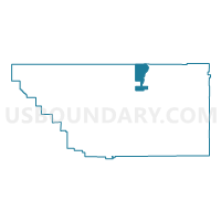
Outline

Summary
| Unique Area Identifier | 531676 |
| Name | Voting District 10000 |
| County | Kern County |
| State | California |
| Area (square miles) | 119.55 |
| Land Area (square miles) | 119.37 |
| Water Area (square miles) | 0.18 |
| % of Land Area | 99.85 |
| % of Water Area | 0.15 |
| Latitude of the Internal Point | 35.68628750 |
| Longtitude of the Internal Point | -118.50330770 |
Maps


Graphs
Select a template below for downloading or customizing gragh for Voting District 10000, Kern County, California


Neighbors
Neighoring Voting District (by Name) Neighboring Voting District on the Map
- Voting District 10005, Kern County, CA
- Voting District 10050, Kern County, CA
- Voting District 10650, Kern County, CA
- Voting District 10680, Kern County, CA
- Voting District 10685, Kern County, CA
- Voting District 10925, Kern County, CA
- Voting District 55290, Tulare County, CA
- Voting District 55455, Tulare County, CA
Top 10 Neighboring County Subdivision (by Population) Neighboring County Subdivision on the Map
Top 10 Neighboring Place (by Population) Neighboring Place on the Map
- Lake Isabella CDP, CA (3,466)
- Wofford Heights CDP, CA (2,200)
- Bodfish CDP, CA (1,956)
- Kernville CDP, CA (1,395)
Top 10 Neighboring Elementary School District (by Population) Neighboring Elementary School District on the Map
- Kernville Union Elementary School District, CA (11,432)
- Linns Valley-Poso Flat Union School District, CA (612)
- Hot Springs Elementary School District, CA (317)
Top 10 Neighboring Secondary School District (by Population) Neighboring Secondary School District on the Map
- Kern Union High School District, CA (596,351)
- Porterville Unified (9-12) School District, CA (47,072)
Top 10 Neighboring State Legislative District Lower Chamber (by Population) Neighboring State Legislative District Lower Chamber on the Map
- Assembly District 32, CA (547,084)
- Assembly District 30, CA (504,729)
- Assembly District 34, CA (487,193)
Top 10 Neighboring State Legislative District Upper Chamber (by Population) Neighboring State Legislative District Upper Chamber on the Map
Top 10 Neighboring 111th Congressional District (by Population) Neighboring 111th Congressional District on the Map
Top 10 Neighboring Census Tract (by Population) Neighboring Census Tract on the Map
- Census Tract 52.04, Kern County, CA (6,158)
- Census Tract 27, Tulare County, CA (5,615)
- Census Tract 52.01, Kern County, CA (5,397)
- Census Tract 52.03, Kern County, CA (4,679)
Top 10 Neighboring 5-Digit ZIP Code Tabulation Area (by Population) Neighboring 5-Digit ZIP Code Tabulation Area on the Map
- 93306, CA (64,587)
- 93240, CA (6,056)
- 93285, CA (2,536)
- 93205, CA (2,113)
- 93238, CA (1,490)
- 93518, CA (1,146)
- 93226, CA (282)
- 93260, CA (200)